ARGENTINE RAILWAYS
MAPS OF RAILWAY NETWORK DEVELOPMENT
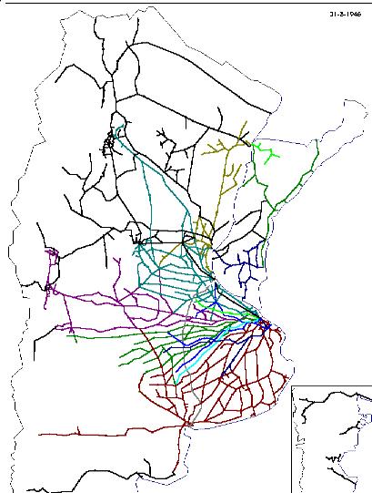
FFCC.EXE is a Windows 32-bit computer program that draws maps of the common carrier railway network at any date between 1857 and 1961. Line sections are drawn on screen when built and erased when abandoned with indication of their name, length, and date of opening or abandonment.
The user can select beginning and ending dates between which the network changes are mapped and can see the changes in one go to their final state, or in animated form drawing sequentially through time at the pace of about 5 seconds per year, or line by line at every click of a button.
The user can select the appearance of the maps by choosing the scale and the line drawing width. Each section is drawn in a colour determined by reference to different colour codes for different railway companies. Colours change as lines are transferred by amalgamation, privatization, or nationalization.
Any map can be saved on disk for further use in a word-processing program. The various maps can be of (1) the country as a whole or of (2) Buenos Aires, (3) Greater Buenos Aires, or the environs of (4) Bahía Blanca, (5) Córdoba, (6) Mendoza, (7) Rosario, (8) Santa Fe and (9) Tucumán.
Line lengths and dates of opening were obtained from the official railway statistics and annual reports of the companies. Abandonment dates are from the same sources and press reports.
Click here to see how to obtain this computer program.
![]()
![]()